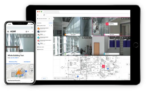
Digital Twin Services offers a software that creates a spatially accurate 3D Digital Twin with 360° photos & videos.
We track all visual data in one interactive, measurable, cloud-based platform including 360° photos, video, documentation, LIDAR, CAD, BIM and more . It helps you more efficiently track progress, reduce rework, and prevent disputes all in one place.
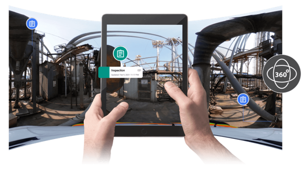
Increase your situational awareness of your facility – a 360° panorama virtual walkthrough at your fingertips.
Digital Twin is the Google Street View for inside commercial properties. We optimize the planning, design, project management and maintenance phases of the building management process by reducing rework or change orders.
The Benefits of Digital Twin Services:
Reduces the number of site visits – conduct virtual assessments and inspections of your site instead.
Annotate, track issues, and create reports – know when changes are needed and completed.
Increase productivity – reduce the number of site visits, optimize stakeholder communication, identify issues earlier, and implement solutions quicker.
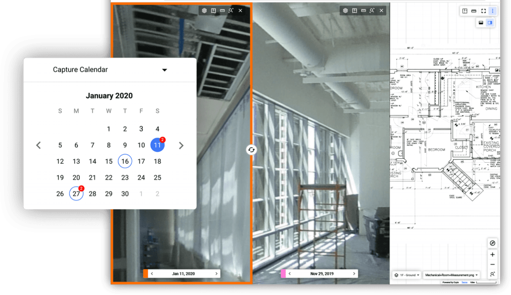
Accurate project tracking – compare the same property taken at different times. You can see the progress between the two digital twins.
Enhance collaboration – the Digital Twins of your facility can be accessed anywhere, anytime.
Digital Twin Webinar
Our team at M3T Corporation would love to turn your physical facility into a virtual environment.
We want to help you protect and maintain your assets and facility
by utilizing these innovative Digital Twins.
Don’t hesitate to reach out to us for more information. We’d love to chat with you!